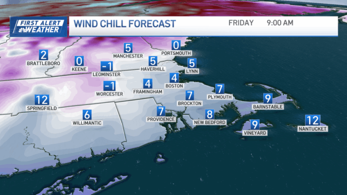
It was a cold, snowy start to the new year! In fact, several neighborhoods around central and eastern Massachusetts received a few inches of snow through New Year’s morning. But now our attention turns from the snow to the bitter cold.
Before heading out the door today, remember two things. First, watch your step! With temperatures below freezing, any lingering snow on sidewalks, porches and untreated roads will be icy. Slow down and be careful.
And second, bundle up! Breezy west winds will keep feels-like temperatures in the single digits for much of this morning here in Greater Boston. By this afternoon, feels-like temps will only rise into the teens. We’ll see a mix of clouds and sunshine today, with more sun by afternoon.
The chill will continue through Saturday and Sunday. Morning temps will be in the teens. High temperatures will be in the upper 20s to near 30. Expect sunshine Saturday, but by Saturday night, a quick-moving system will deliver a few snow flurries/showers to the region right into Sunday morning. Little to no accumulation is expected right now. This will not be a major storm for our area.
However, early next week, a more robust system from Canada might bring us a slightly better chance of snow. The system arrives late Monday into Tuesday. Some accumulations are possible. We’ll keep you posted.
Warmer weather arrives by the middle of next week. We’re tracking highs in the low to mid 40s!


